Earth Station Key Properties
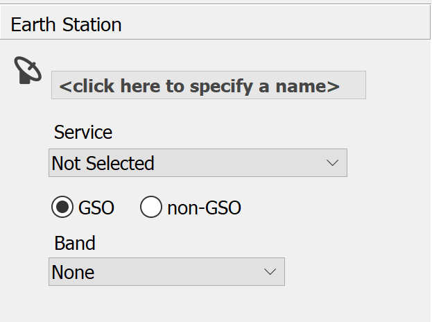
The first thing you need to do is specify the name, service, GSO / non-GSO and frequency band for your earth station. This is done using the controls at the top of the Properties side bar.

The earth station name is displayed in bold at the top of the side bar. To change the earth station name, simply click where the prompt is, type the name you require and then press the return key.
Click the Service drop-down list to select a service type. Service determines the frequency and type of earth station (fixed or mobile). It also determines whether the earth station is a transmitter, receiver or both.
The application defaults to a GSO system - you can change this by clicking non-GSO.
The Band drop down list will automatically select the lowest frequency band for the earth station, based on the selected service. Visualyse Coordinate automatically assigns your earth station with the full bandwidths of the allocations defined in the Frequency Allocation table of the Radio Regulations.
The Service provides enough information to allow Visualyse Coordinate to set up an Assessment with many default parameters
Once the Service has been defined, the application window will change to show the Map view. The Appendix 7 contour and the affected administrations for each applicable sharing scenario will be shown.
At this stage, Visualyse Coordinate has assumed a great many default parameters for your earth station. In order to model your specific earth station, you must work through these defaults replacing them with authentic values for your system.
The following subsections describe in detail how to change these defaults so that Visualyse Coordinate accurately models your earth station.