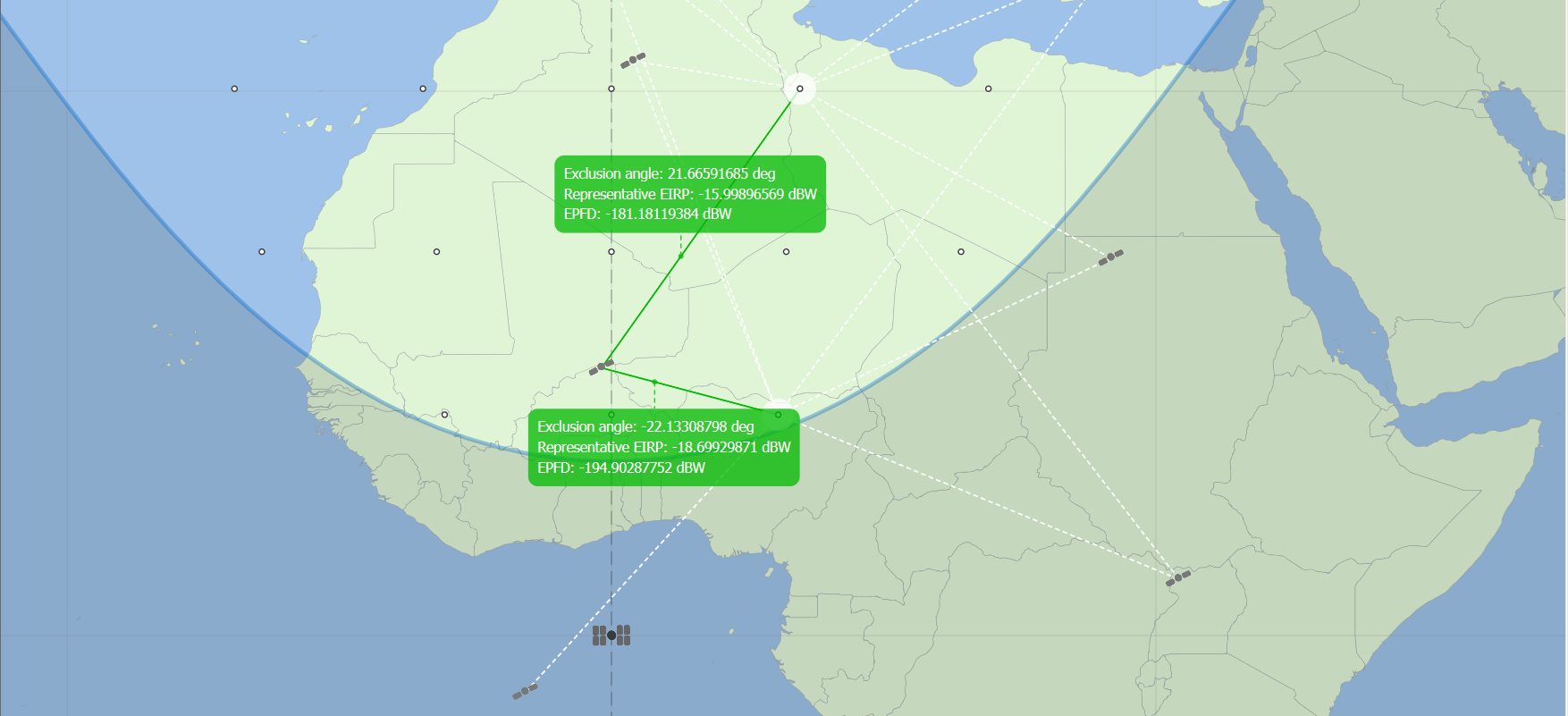
Display parameters for EPFD(up)
The parameters that can be displayed for EPFD(up) runs are as follows:
| Parameter | Description |
|---|---|
| non-GSO Earth station off axis angle | The angle between the line from the non-GSO service area Earth station to the tracked non-GSO satellite and the line from the non-GSO service area Earth station to the GSO satellite. |
| GSO off axis angle | The angle between the pointing direction of the GSO satellite and the line between the GSO satellite and an Earth station in the non-GSO service area. |
| Distance from nonGSO Earth station to GSO satellite | The distance from an Earth station in the non-GSO service area to the GSO satellite. |
| Exclusion Zone angle | The angle between the GSO arc, an Earth station in the non-GSO service area and the non-GSO satellite it is tracking. This angle could be an X or Alpha angle, depending on which of these is defined as the exclusion zone parameter for the run. |
| Elevation Angle | The elevation angle of a tracked nonGSO satellite from the Earth station which is tracking it. |
| Name | The name of each satellite and Earth station. |
| Latitude, Longitude and Height above the Earth | The latitude, longitude and height above the Earth of each satellite and Earth station. |
| Representative EIRP | The EIRP of an Earth station from the non-GSO service area, in the direction of the GSO satellite. This is based on the EIRP from the mask and the density of Earth stations in the non-GSO service area. |
| Relative Gain at the GSO satellite | The relative gain at the GSO satellite. |
| Spreading loss | The loss in the direction of the GSO satellite from each Earth station in the non-GSO service area. |
| EPFD | The EPFD contribution for each Earth station in the non-GSO service area. |
| Total EPFD at the Satellite | Total calculated EPFD at the GSO satellite for the current time step. |
The location parameters (Latitude, Longitude and Height above the Earth and x, y, z coordinates) are shown for each station, including the nonGSO service area stations.
The Total EPFD at the Satellite is obviously only displayed for the GSO satellite.
All the other parameters apply to the link between a nonGSO satellite and an Earth station in the non-GSO service area.
The input parameters define the maximum number of nonGSO satellites that can be tracked by an Earth station. The Earth station will track the satellites which are closest to the GSO arc, but outside the GSO exclusion zone and above the minimum elevation angle.
Links between Earth stations and the nonGSO satellites they are tracking are displayed as green lines in the Scenario window.
Dotted grey and white lines are displayed between Earth stations and nonGSO satellites that are visible, but cannot be tracked. This may occur if the satellite is below the minimum elevation angle or inside the GSO exclusion zone for example.
