Import from the Terrestrial IFIC
This feature interfaces directly to any database that has the structure of the Terrestrial IFIC.
Selecting the Import Terrestrial IFIC from the Model menu or clicking the terrestrial IFIC icon, starts up the dialog.
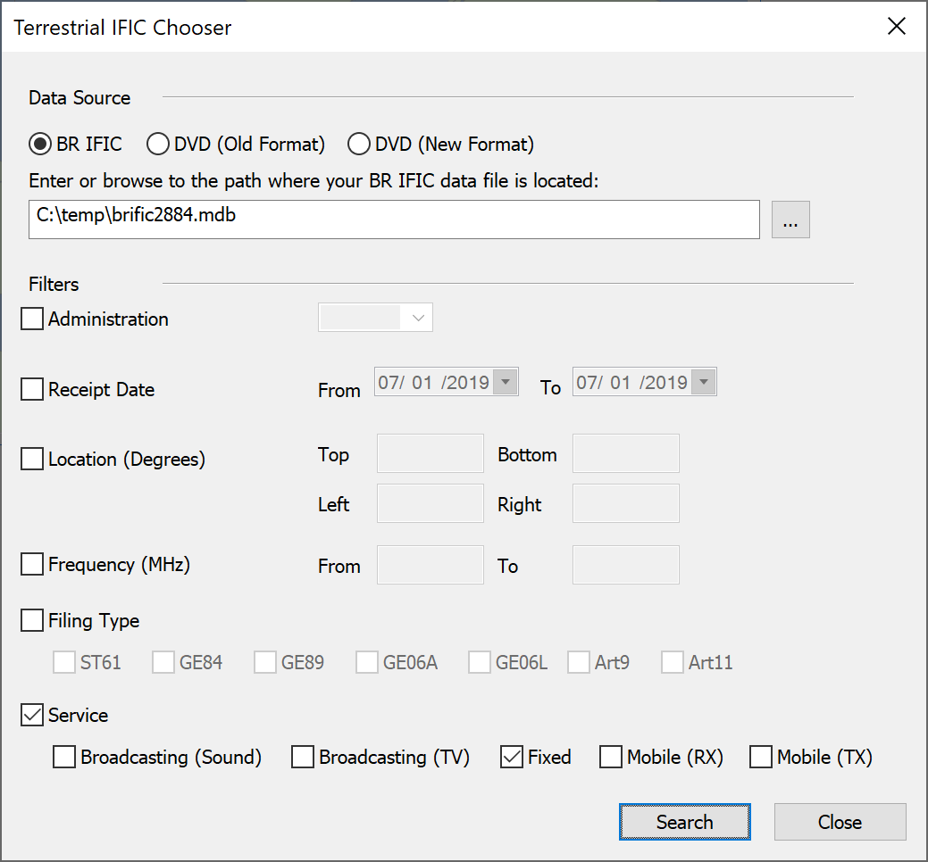
As for the other Import options, the first step is to define the location of your database. The database can be either a single .MDB file downloaded from the ITU website (BR IFIC option) or the collection of database files found on the Terrestrial IFIC DVD (DVD option).
Once this is defined there are number of filter options, which can be applied in combination:
-
Administration - import only filings from the specified administration
-
Receipt date - set a range of ‘receipt dates’ and only import systems filed within that range
-
Location - defined a box by latitude and longitude extremes and only import systems within that area
-
Filing type - import only systems of one or more given filing types
-
Service - import only systems of one or more given service types
Having selected the search criteria and clicked on “Search”, Visualyse Professional will search the Terrestrial IFIC for filings that meet the criteria.
Note that searches with very wide criteria can take a long time to complete – it is recommended to use filtering where ever feasible.
Having searched the IFIC, Visualyse Professional will count the number of records and display them in a dialog similar to this:
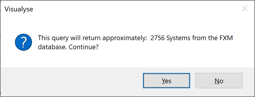
This stage allows you to assess if the number returned is as expected – for example the criteria might too stringent and no systems were found or too wide so that thousands of systems would be imported.
If you are happy with the results click on “Yes” and then Visualyse Professional will load a list of the systems that can then be selected. In addition it checks for duplicate filings – those that have the same parameters apart from one field that Visualyse Professional would not use. For example the same system could be filed for two different reasons, but only one record would be returned.
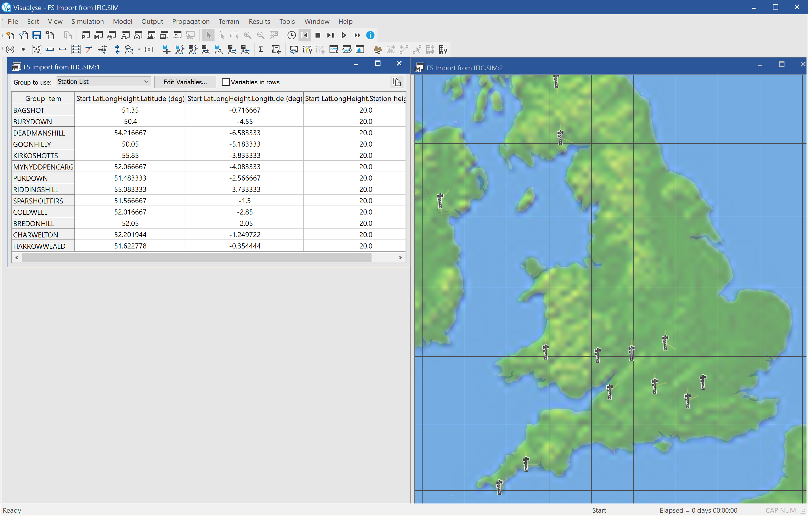
This list would look something like this:
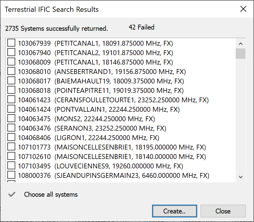
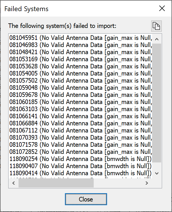
Sometimes the software is unable to load a system due to missing data. Clicking on the “xx Failed” text shows a dialog detailing why the systems failed to load the system.
You can then select all systems or a sub-set of the systems to import into Visualyse Professional.
The Terrestrial IFIC import reads the database and populates the following objects:
- Antennas
- Stations
- Carriers
- Links
The figure below shows an example import and the model view is open to show all the objects created.
Tip: It is worth checking the data returned as there can be fields not defined. For example, in this example two of the stations had antenna height of zero metres – only one had a valid height.