IDWM Module
Introduction
The IDWM module allows you to use data from the ITU Digitized World Map in your propagation models. This includes information such as distance to coast, path over water and radio climatic data.
Visualyse Professional includes implementations of Recommendation ITU-R P.452, Recommendation ITU-R P.1546, Recommendation ITU-R P.1812, Recommendation ITU-R P.2001, and Appendix S.7, all of which use information that can be extracted from the IDWM.
The IDWM database can also be used in your own programs. Full documentation as provided by the ITU is included in electronic format.
This section describes how information from the IDWM can be used in Visualyse Professional propagation models.
Using IDWM
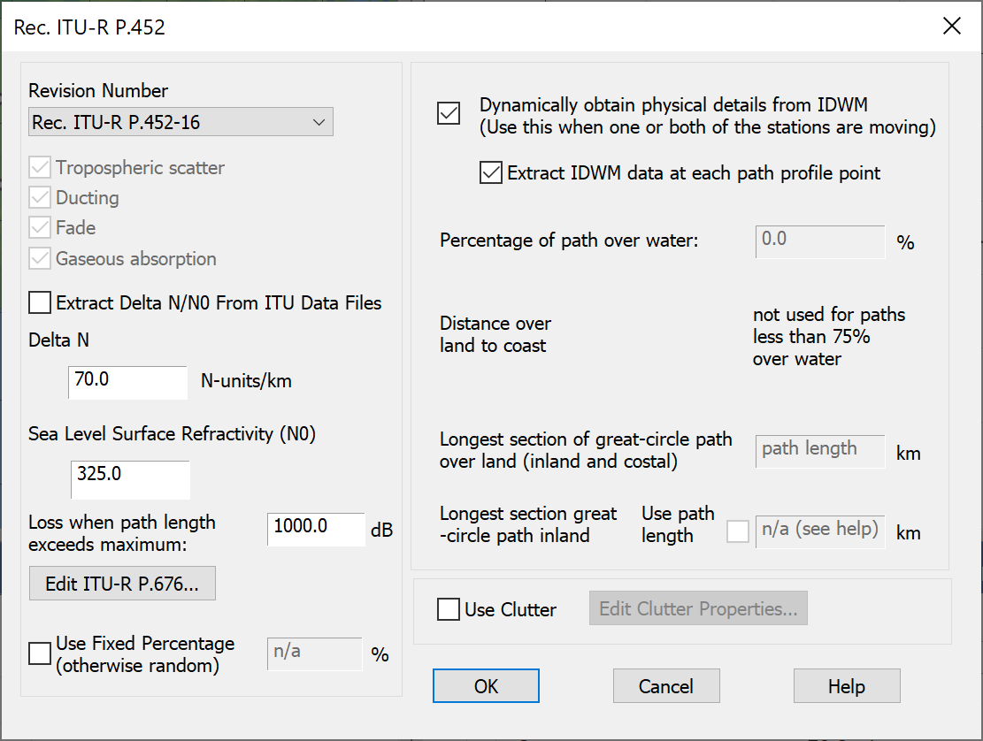
Recommendation ITU-R P.452
The propagation model in Recommendation ITU-R P.452 is very flexible and can be used for most scenarios where it is necessary to calculate interference between terrestrial stations.
A key parameter of the model is how much of the path is over water, how much over coastal areas, and how much over land. This can be entered by hand if known, but where it is not these can be extracted from IDWM, as in the figure below.
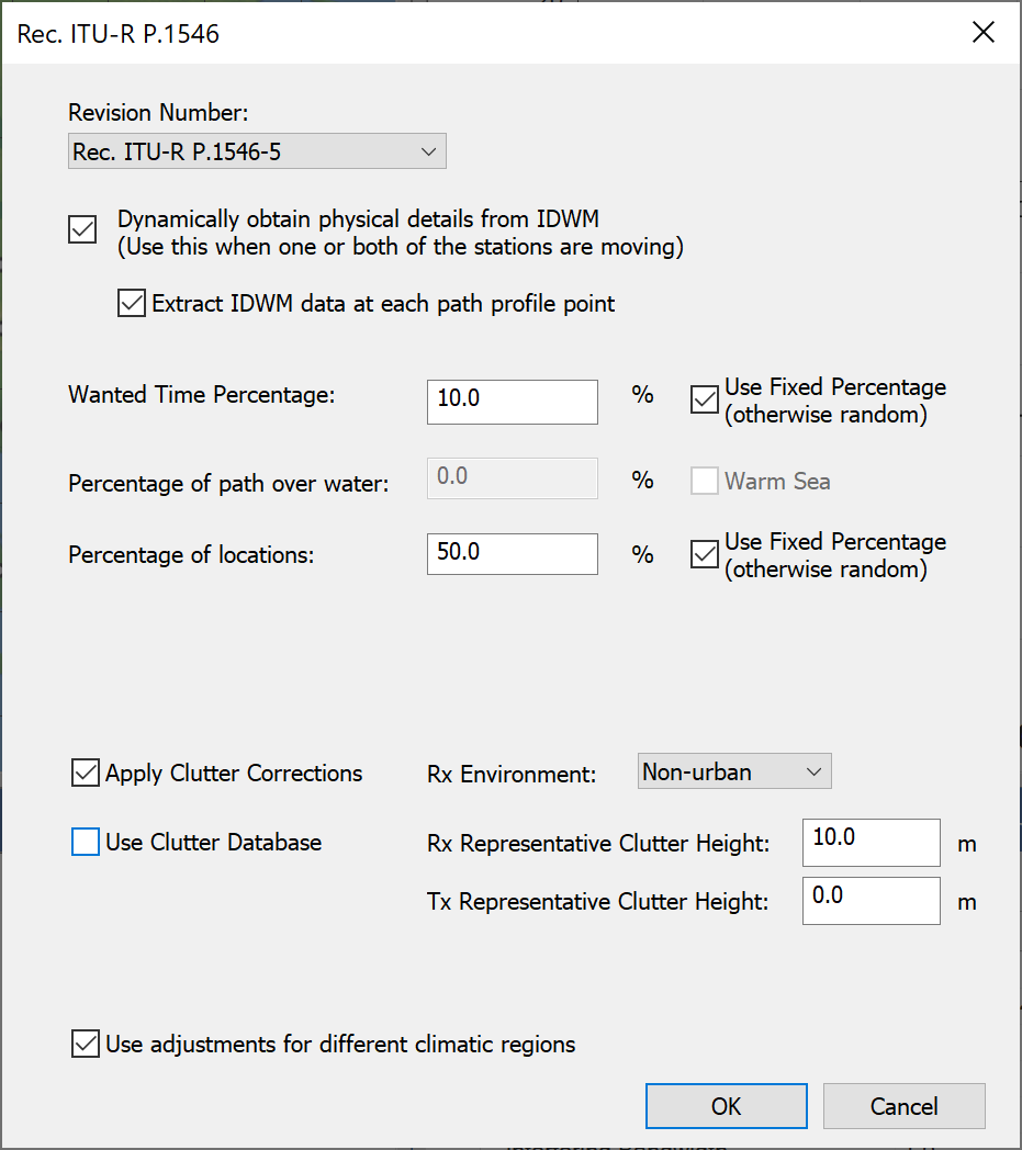
Recommendation ITU-R P.1546
The propagation model in Recommendation ITU-R P.1546 is very powerful and is the basis of broadcasting networks planning. As with Recommendation P.452, a key parameter of the model is how much of the path is over water. This can be entered by hand if known, but where it is not these can be extracted from IDWM, as in the figure below.
Recommendation ITU-R P.1812
The propagation model in Recommendation ITU-R P.1812 combines aspects of Recs ITU-R P.452 and P.1546, in that it:
- Undertakes path specific analysis using a terrain database in a similar way to Rec. ITU-R P.452
- Includes a location dependent clutter model similar to that in Rec. ITU-R P.1546
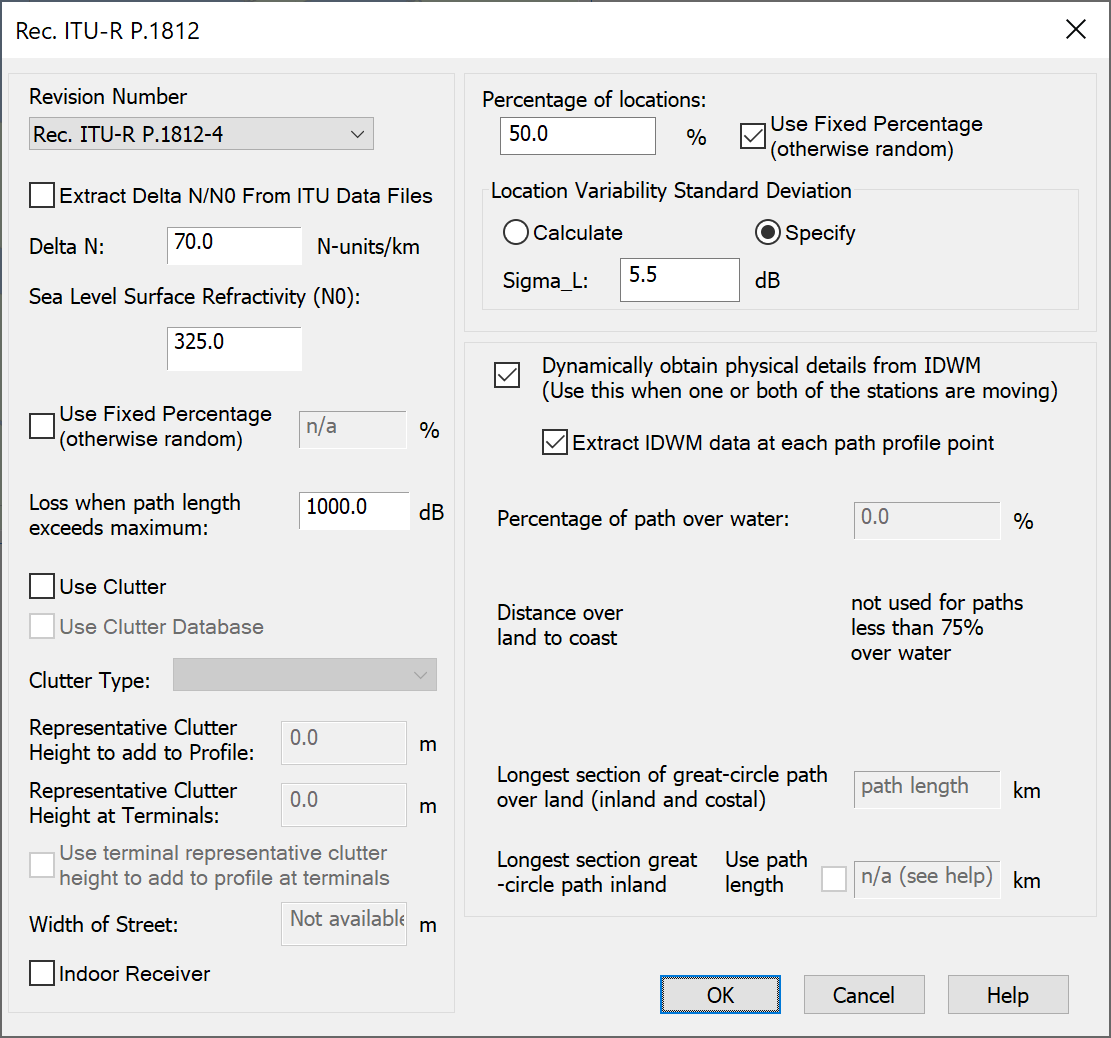
The path analysis part can use IDWM, in a similar way to the Rec. ITU-R P.452.
Recommendation ITU-R P.2001
This Recommendation has similarities with both P.452 and P.1812 in its handling of terrain paths but extends both to cover the full range of percentage of times [0.00001% to 99.99999%].
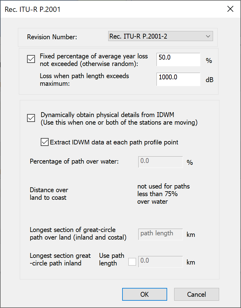
The path analysis part can use IDWM, in a similar way to the Rec. ITU-R P.452.
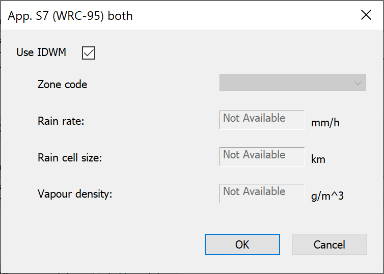
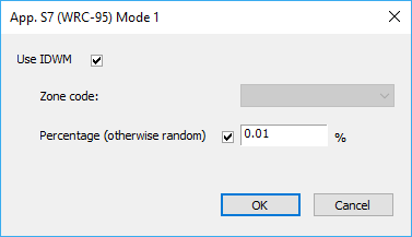
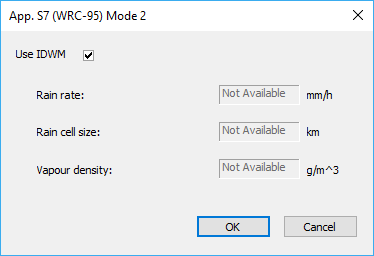
Appendix S.7
The propagation model in Appendix S.7 of the Radio Regulations can be used to calculate whether coordination is required between stations of the fixed service and satellite earth stations.
This model uses parameters that are within IDWM including:
Mode 1 propagation: Zone (A, B or C)
Mode 2 propagation: Rain rate, rain cell size, water vapour density
If you select these propagation models and you have the IDWM module you have the option for these parameters to be extracted automatically and hence they can vary depending upon location.
The configuration dialogs are shown below.
The Appendix S7 Combined model uses all the parameters, as in the figure below.