Dynamic Link
These differ from fixed links by the fact that the start and end stations can change as the simulation runs.
The start end, end start, Traffic and Advanced tabs are therefore the same as for Fixed Links. The only differences are the start and end station tabs.
Start Station
The start station tab is shown below.
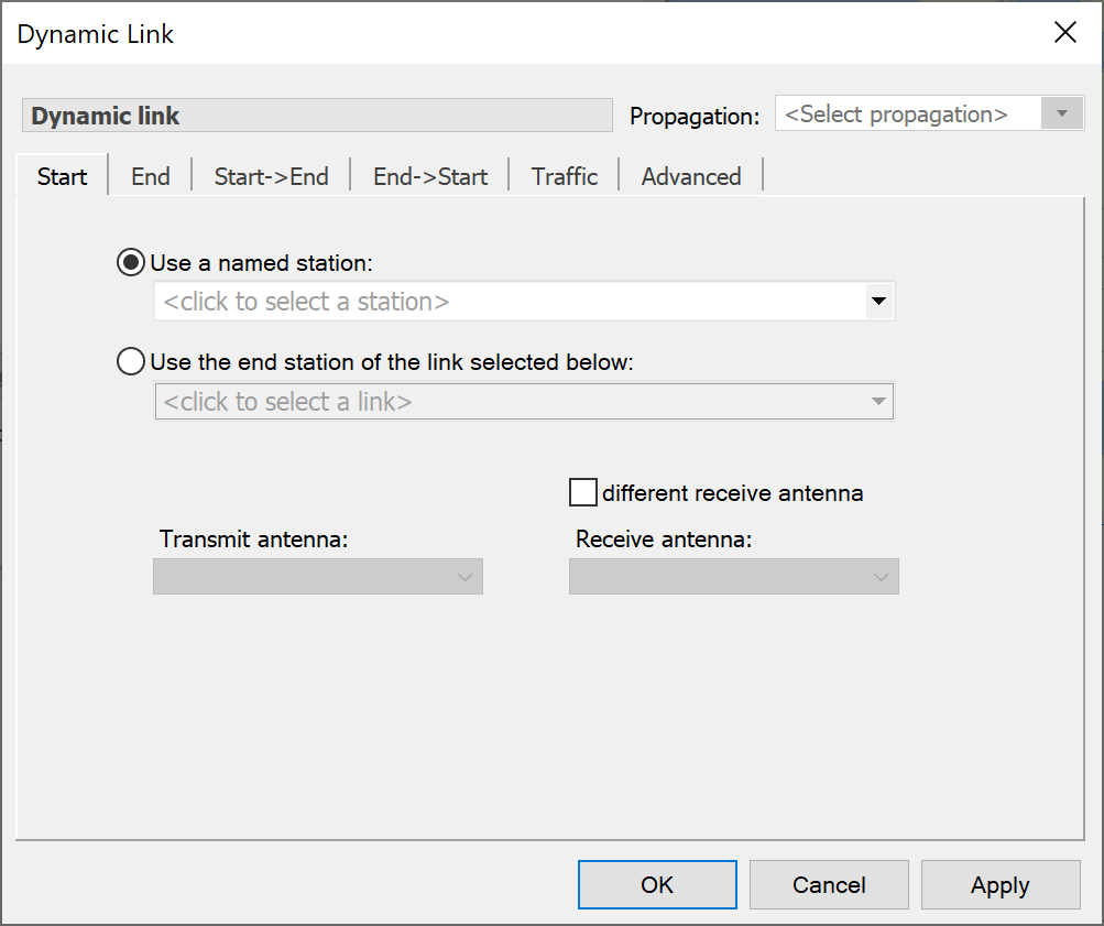
Two options are provided for the selection of start station use a named station (just like a fixed link) and use the end station of another link. The second option allows you to chain together Dynamic Links and therefore model, for example, the inter-satellite links in a non-GSO constellation.
You must also select the Antenna and Beam to start the Link on. Select either a named Antenna and Beam or pick any Antenna/Beam combination capable of tracking the end station. If you take the second option, Visualyse will manage the available resources and select the first available antenna.
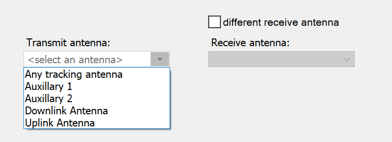
Select either ‘Any tracking antenna’ or an antenna from the list.
Beam selection is a little more complex. The options are shown below.
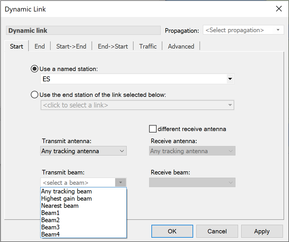
Beam selection options are:
- Any tracking beam – Visualyse will choose the first available steerable beam
- Highest gain beam – Visualyse will choose a beam from the selected antenna that has the highest gain
- Nearest beam – Visualyse will choose a beam from the selected antenna, whose boresight latitude and longitude are closest to the location of the End station.
End Station
The End tab for a Dynamic Link is shown below.
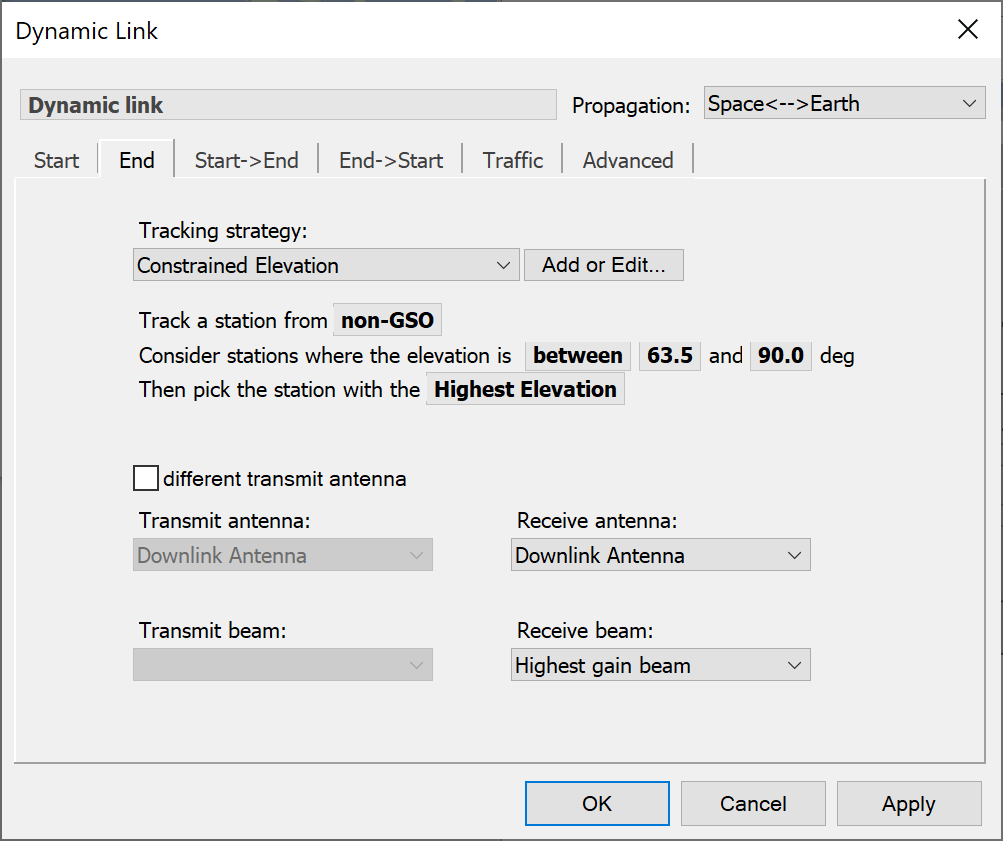
The unique feature of the End Station selection is the use of a ‘Tracking Strategy’.
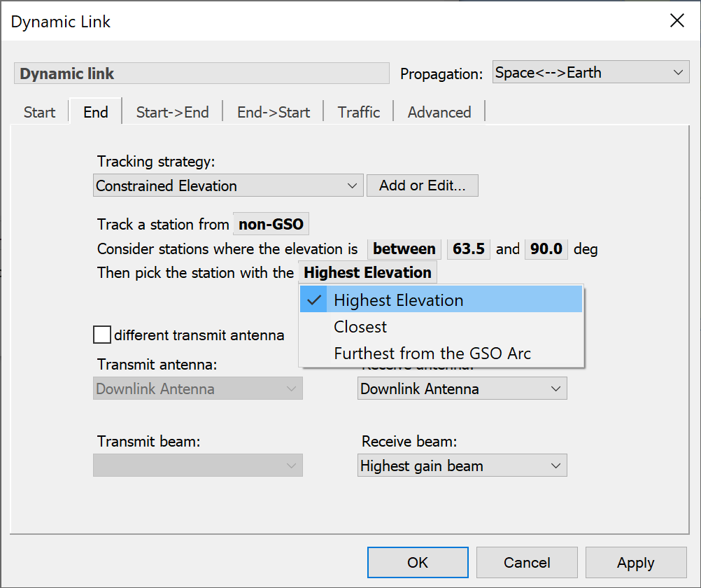
Tracking Strategy
Select a Tracking Strategy from the drop-down list. You can choose either a built-in strategy or a strategy you can define yourself (see Tracking Strategies).
Each built in tracking strategy has a set of parameters needed to fully define it. Each strategy must be applied to a specific Group of Stations (see Station Groups) and this is selected by clicking on the highlighted text labelled “Track a Station from”.
As an example of other parameters needed, the tracking strategy we call ‘Constrained Elevation’ allows you to track a station that has the highest elevation but meets the constraint that the elevation is between two limits. This is shown below.
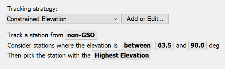
The parameters you can change are bold and highlighted. As you pass the mouse over them, the cursor will change. Click and you can edit them. Click away or press Return, and your changes are made.
For items that are not values, but items selected from a list e.g. the Station Group to be tracked, the operation is slightly different. The cursor changes to a hand when you pass over the item. Click and hold to produce a pop-up list, then drag to the item you want and release. The non-GSO and Highest elevation options in the example work in this way.
The following tracking strategies have been built into the simulation and can be selected directly on the End Station tab of the Dynamic Link
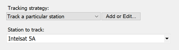
Track a Single Station
This tracking strategy isn’t really a tracking ‘strategy’ at all because it always tracks the same station.
Constrained Elevation
Several parameters need to be given to fully specify this tracking strategy:
- The Group (constellation) to select Stations from
- The elevation constraint type
- Up to two constraining angles (depending on the constraint type)
The selection criterion where more than one stations meets the constraints.
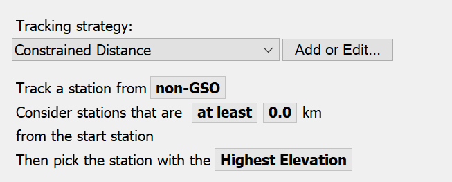
Constrained Distance
This is the same as Constrained Elevation, except that distance from the start station is the constraint.
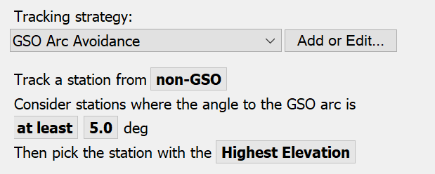
GSO Arc Avoidance
In this strategy the angle between the candidate station and the nearest point on the geostationary arc,
End stations are only considered if the angle between them, the start station and the GSO arc is above a minimum value. Once again, in the case where there are multiple candidates, the station with the highest elevation or longest hold time is selected.
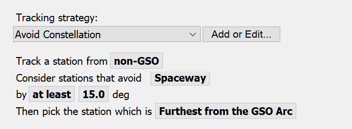
Avoid Constellation
This tracking strategy ensures that the end station chosen such that the angles between it, the start station and every other station in a given constellation are above a particular minimum value.
What we’re saying here is make sure that the start station doesn’t pick an end station that would have it pointing too close to any of the stations in another constellation.
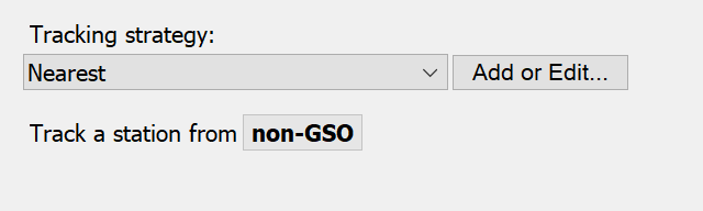
Nearest
This selects the nearest Station from the Group of possible Stations.
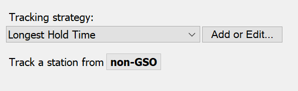
Longest Hold Time
This selects the Station from the Group of possible Stations that is heading towards the start Station and could be tracked for the longest possible time without requiring handover. This is done by calculating the dot product of relative position and velocity vectors.
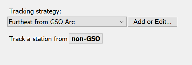
Furthest from GSO Arc
This selects the Station that has largest angle as seen by the start Station towards the GSO Arc.
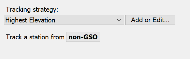
Highest Elevation
This tracking strategy selects the highest elevation Station as seen by the Start Station from the selected Group.
Antenna and Beam Options
Selection of the end station also requires that the Antenna and Beam be specified. For the Antenna you can select:
- Highest gain antenna
- Any tracking antenna
- Select an antenna by name.
Beam selection options are:
- Any tracking beam – Visualyse will choose the first available steerable beam
- Highest gain beam – Visualyse will choose a beam from the selected antenna that has the highest gain
- Nearest beam – Visualyse will choose a beam from the selected antenna, whose boresight latitude and longitude are closest to the location of the End station.
If this Link is to be bi-directional you can select a different Antenna and Beam for the EndStart path.